
XGRIDS · ENTERPRISE SLAM LIDAR IN STOCK
Lixel L3
Accuracy meets photorealism.
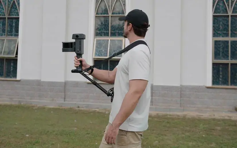
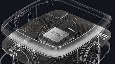
The Xgrids Lixel L3 is the new flagship handheld SLAM scanner: 5mm relative accuracy, built-in survey-grade RTK, and a three-camera 4K HDR true-colour system, with the RTK, the screen and the processing all inside the unit. One walk delivers a survey-grade point cloud, a photoreal 3D Gaussian Splatting scene and a mesh. Available to order in Australia through Kybos.


2cm
ABSOLUTE ACCURACY
5mm
RELATIVE ACCURACY
3x 50MP 4K HDR
CAMERAS
2.5KG
WITH BATTERY
L3 vs L2 Pro
Precision, or range and mounting.
The L3 doesn't replace the L2 Pro. The L3 leads on accuracy, colour and integration; the L2 Pro stays the long-range, mount-anything workhorse. Two tools for different jobs.
Precision, Scan-to-BIM, integration
Corridors, large sites, mounted
Fast, light, everyday capture
The L2 Pro is the only model with a 300m LiDAR option and vehicle / drone mounting. The K2 is the light everyday scanner for fast, portable capture. Each stays the right tool for its job.

SEE WHAT IT CAPTURES
See a L3 video.
WHAT IT IS
The camera.
The Xgrids Lixel L3 is the new flagship handheld SLAM scanner: 5mm relative accuracy, built-in survey-grade RTK, and a three-camera 4K HDR true-colour system, with the RTK, the screen and the processing all inside the unit. One walk delivers a survey-grade point cloud, a photoreal 3D Gaussian Splatting scene and a mesh. Available to order in Australia through Kybos.
WHO IT'S FOR
The buyer.
For surveying, Scan-to-BIM, infrastructure, facility and asset capture, mining and film: anyone who needs survey-grade accuracy and photoreal colour from a single handheld pass, with control points, RTK and on-device processing built in.


SPECIFICATIONS
The details.
PHYSICAL
BODY WEIGHT
~2.5kg (incl. battery)
DIMENSIONS
206 × 107 × 329 mm
HOUSING
Aluminium alloy · IP54
WORKING TEMPERATURE
−20°C to 50°C · <30W
LIDAR SYSTEM
LASER CLASS
Class 1 / 905nm
SCANNING RANGE
0.7-120m
FIELD OF VIEW
360° × 270°
POINT RATE
320,000 / 640,000 points/second
ACCURACY
5mm relative / 2 cm Absolute
CAMERA SYSTEM
CONFIGURATION
3 × 1/1.3" CMOS · 2 panoramic + 1 forward
IMAGE RESOLUTION
4096 × 3072 · DCG 4K HDR
Forward FOV
100° × 85°
PANO FIELD OF VIEW
200° × 200° (each panoramic)
POWER
BATTERY
14.4V 3,350mAh quick-swap
OPERATING TIME
~100 min continuous scanning
BATTERY CAPACITY
46.8 Wh
OPERATING TEMP
-20°C to 50°C
CONNECTIVITY & STORAGE
DATA INTERFACE
USB 3.1 Gen 2
INTERNAL STORAGE
1TB UFS
RTK
Built-in survey-grade · BDS, GPS, GLONASS, Galileo, QZSS
DISPLAY
4.3" TFT · up to 1,000 nits
OUTPUT & SOFTWARE
ON-DEVICE
Loop closure · levelling · moving-object removal · noise filtering
PROCESSING
LixelStudio · local upsampling (POI) · control-point-free fusion
EXPORT
.las / .rcp / .e57 / .ply / .ilas
MESH & 3DGS
.osgb / .obj · .lcc / .lcc2 / .ply · 3D Tiles / .usd
INTEGRATION
Revit (Scan-to-BIM) · Unreal Engine · Unity · ArcGIS · NVIDIA Isaac Sim
SOFTWARE INCLUDED
LixelStudio (3 permanent licences) · LCC Basic · onboarding & training
PACKAGES
What's in the box.
Not every team needs to own a scanner. Kybos captures the site and delivers the browser-shareable 3D, with no hardware to buy or learn.
BEST FOR
Where it's used
• Surveying and mapping at 2cm absolute
• Construction verification and Scan-to-BIM
• Infrastructure: bridges, tunnels, corridors
• Facility and asset digital twins
• Mining, heritage and film / virtual production


HOW TO GET ONE
For some projects, hire is the better call than purchase. Ask about availability.
FAQ
How is the L3 different from the L2 Pro?
Is the L3 accurate enough for survey work?
What can I do with the output?
Does it have built-in RTK?
Can L3 data be processed without the cloud?
How much is the Lixel L3 and when can I get one?
Do you offer support and warranty?
